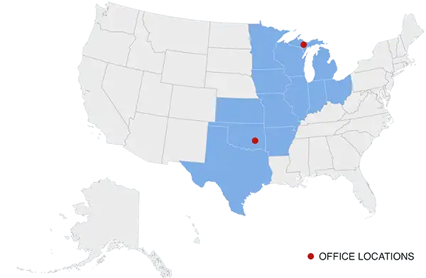
 Arrowhead Environmental provides geophysics services to municipalities, land owners, developers, and financial institutions to identify what lies below the surface of a property.
Geophysics services uses high tech equipment to locate large objects underground, such as a ridge of rock, or an old underground storage tank, or even human remains. Developers will want to sweep an area with geophysical equipment to make sure there are no impacts below the surface that could complicate construction, or stop development entirely.
No digging is required. No destruction of surface materials is needed. All scanning is accomplished with high tech equipment designed to “see” into the soil and discover what’s there.
What Can Geophysics Services Detect?
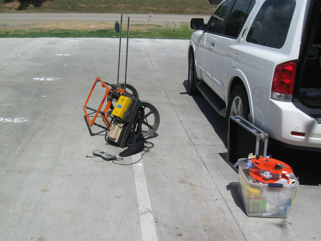
Arrowhead Environmental owns an array of high tech equipment designed to locate various types of materials underground. This equipment can find metal structures, mineral and metal deposits, water, contaminants, and more. Geophysics equipment can produce printed reports that illustrate the location and depths of these objects, including 2D and 3D data visualization, mapping, and modeling techniques…
- Pinpoint the location and depth of underground storage tanks (UST), whether they are made of metal, fiberglass, or plastic
- Scan through concrete and asphalt. No digging or destruction of surfaces is necessary
- Detect the presence of rebar within concrete
- Locate aquifers for the purpose of drilling wells
- Determine stormwater injection potential
- Locate potential sink holes
- Assist in the evaluation of brownfields
- Detect any unexploded ordinance (mines, traps)
- Mapping ancient archaeological remains
- Map the flow of a contaminant plume
- Identify leaks in an earthen dam
- Mapping the location of underground utilities and pipes
Types of Geophysics Equipment In Use
There are different types of geophysics equipment that can be used based on the materials being searched for, the type of surface being scanned, and the site conditions. These technologies include…
- Ground penetrating radar (GPR)
- Electrical resistivity tomography
- Seismic refraction and reflection equipment
- Electromagnetic metal detectors
- Magnetometers
- Radiometers
The depth of exploration with these types of equipment varies from a few inches to hundreds of feet. In addition to operating these instruments and gathering information, a geophysics service includes the analysis and interpretation of data, finalized with the preparation of images and graphs meaningful to the client.
Hire a Geophysics Services Provider
Arrowhead Environmental employs a team of licensed environmental engineers trained in the operation of geophysics equipment.